Ash Masters
Researchers field volcanic ash warning system.
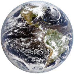
From a workstation in Madison, Mike Pavolonis MS’02 hopes to lay eyes — satellite eyes, that is — on every natural chimney around the globe.
“Our eventual goal is a fully automated global ash monitoring system,” says Pavolonis, a researcher from the National Oceanic and Atmospheric Administration (NOAA) working at the UW’s Cooperative Institute for Meteorological Satellite Studies. “Satellites will supply data that will be processed, and all of it will be operational. Every volcano will be automatically monitored. Satellite data will be used in models to predict where the ash will go.”
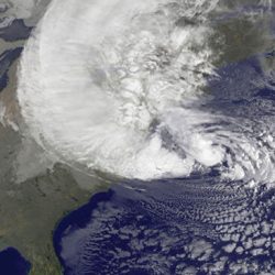
The importance of those predictions has rarely been more obvious than it was in March and April, when ash from the Icelandic volcano Eyjafjallaj√∂kull shut down some of the world’s busiest air routes.
NOAA has been working with UW-Madison for fifteen years to develop accurate ash monitoring methods for areas with active volcanoes. While the mountains may seem remote, they often lie along well-traveled pieces of sky. For example, Alaska’s sparsely populated Aleutian Islands are on the great circle route between Asia and North America. Every year, more than fifty thousand aircraft fly through the area, which has forty volcanoes.
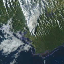
Satellite observation is often the only way to collect data from such remote areas, but simple pictures are not enough to guide safety decisions.
“Satellite imagery alone doesn’t give you the quantitative information you need,” Pavolonis says. “We need to go beyond the visual and determine the characteristics of the ash cloud. How high is it? How much ash is in the cloud? What direction will it travel?”
As the Iceland eruption made clear, ash plumes can cause problems over wide swaths of the sky. Air-traffic-control organizations need to react quickly to divert planes around clouds or ground them to avoid engine damage from the large particles in the air.
Pavolonis and his group began developing an algorithm to boost the utility of satellite images five years ago. Their computational instructions tap satellites in geostationary orbit for data to help determine the presence, altitude and density of ash clouds, as well as the size of the ash particles in the cloud.
“Right now, it takes a good deal of training to get the best information,” he says. “We have to be very careful of the flow of information because this has real impact. With the stakes this high, there is little room for error.”
Published in the Summer 2010 issue
Comments
No comments posted yet.