Making Air Travel Safer
The UW devises a tool to detect fog and low-lying clouds.

The new software is saving airlines millions of dollars each year by helping them avoid delays. Corey Calvert
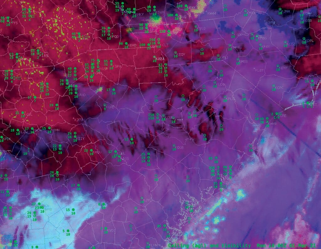
If you experience fewer air travel delays in the years ahead, you can thank your alma mater. UW–Madison’s Cooperative Institute for Meteorological Satellite Studies (CIMSS) collaborated on new software with the National Oceanic and Atmospheric Administration (NOAA), providing a new tool for the National Weather Service to detect fog and low-lying clouds. The software, which took more than 10 years to develop, uses machine-learning techniques with near real-time data from weather satellites to monitor conditions 24/7 and issue potential fog warnings.
Satellite observations have traditionally struggled to determine the size of fog patches, especially when other clouds were present above the fog. Additionally, previous techniques were limited to nighttime use due to interference from reflected sunlight. Unlike thunderstorms that contain larger raindrops and ice crystals, fog is composed of smaller droplets that do not show up on radar.
The new tool, which circumvents those problems, is known as the GOES-R Fog and Low Stratus product. (GOES-R refers to the nation’s most advanced fleet of weather satellites.) According to CIMSS scientist Corey Calvert, the software “helps identify the type of fog over an area by evaluating every pixel in an image and generating a probability of the presence of fog and its intensity.”
The product is saving airlines millions of dollars each year by helping them avoid delays. According to the Federal Aviation Administration, weather was responsible for nearly 70 percent of flight delays from 2008 to 2013. Each hour of delay costs airlines from $1,000 to $4,000 per flight.
The new tool identifies dangerous conditions for both large and small aircraft and can be used to issue warnings around the country, making air travel safer.
Published in the Summer 2022 issue


Comments
No comments posted yet.