Five Ways UW Satellite Technology Saves Lives
Badger meteorologists use high-tech tools to keep Americans safe.
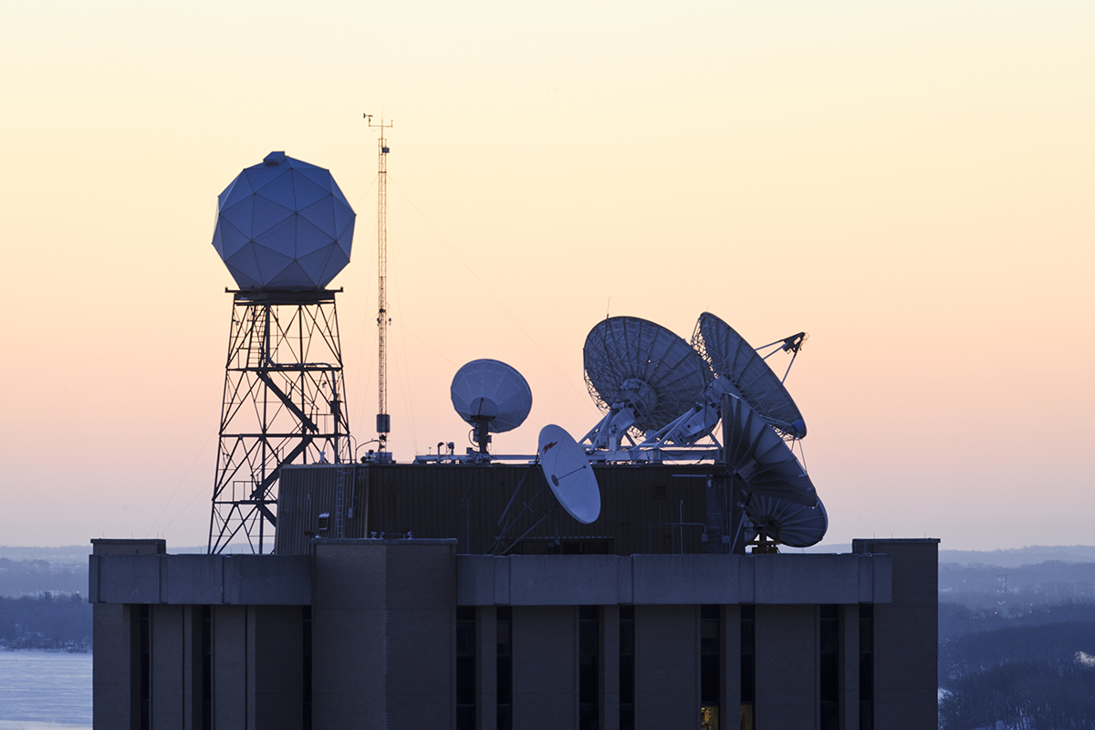
For more than 40 years, UW researchers have been working to turn satellite data into faster and more accurate weather forecasts. Althea Dotzour
The University of Wisconsin–Madison may be the birthplace of satellite meteorology, but scientists on campus have never stopped developing new ways for space-based instruments to protect and improve the lives of people back on Earth.
For more than 40 years, researchers at the Cooperative Institute for Meteorological Satellite Studies (CIMSS) — a partnership between UW–Madison and the National Oceanic and Atmospheric Administration (NOAA) — have been working to turn satellite data into faster and more accurate weather forecasts. They are protecting you and your community in ways you may not expect.
“Technology is constantly advancing, improving our ability to observe our surroundings and enhancing our lives,” says Tristan L’Ecuyer, CIMSS director and a satellite researcher. “The innovative research we do here plays a critical role in delivering essential satellite products that support NOAA’s mission to improve public safety and well-being and effectively manage our nation’s resources.”
Here are just a few of the most recent ways CIMSS has made Americans safer:
- AI-assisted hurricane prediction: Used by agencies worldwide, CIMSS algorithms add speed and accuracy to assessments of hurricanes that can abruptly grow stronger and shift their tracks.
- Dodging lightning: A CIMSS-built tool called ProbSevere employs AI to sharpen severe weather predictions, shortening the wait for forecasts that protect people and their property from lightning, heavy rain, hail, and tornadoes.
- Fighting wildfires: The CIMSS-designed Next Generation Fire System provides highly accurate, real-time information on a wildfire’s location, movement, size, and intensity.
- Protecting against floods: The National Weather Service uses a mapping tool developed at CIMSS to quickly provide situational awareness of changing conditions and flood risks.
- Smoother and safer airplane flights: Researchers working on the CIMSS Turbulence Product use AI to help pilots avoid the atmospheric conditions that make flights uncomfortably bumpy — or worse.
Published in the Fall 2025 issue


Comments
No comments posted yet.